Crete 4: Samaria (Sunday 28 April)

Today we are off to the Samaria Gorge, with high anticipation.  We set 5 am alarms (!) to be ready for the bus at 6.15 am.  As we do the 10-minute walk through the dawn to the bus pickup point outside the Tellus travel agency, the town is still humming with nightlife: the clubs and bars are full (as are many of the patrons) and young men are revving the engines of cars and bikes.  Phoooaaarrr.

We’re on the bus and under way by 6.30 am, part of a group of about 20.  Our guide (Marco, a handsome young Cretan with a nice turn of phrase) explains the way it will work: the bus takes us to the entrance to the Samaria National Park at the top of the gorge, from where we all walk through the gorge (16 km, and a descent of around 1200 m) to the small town of Agios Roumeli on the south coast of Crete.  We walk at our own pace (with Marco last in case of problems) and meet at the Kri Kri hotel to catch a 4.30 pm ferry to Sougia, about 15 km to the west, where the bus meets us for the return trip to Chania.  The ferry journey is needed because Agios Roumeli is accessible only by water.  Marco also tells us that we’re the first walking party for the spring, and later in the year the gorge will be crowded.  Hence, we are doubly lucky in our timing: to be able to do the walk at all, and also to do it at an uncrowded time.

We arrive at the top of Samaria Gorge around 8 am, after a short stop along the way for coffee and pastries.  The bus has to negotiate a winding mountain road with hair-raising hairpin bends, and with a lot of road-building equipment here and there because the road is being upgraded to cope with the volume of tourist traffic to the gorge.

As we alight at the top of the gorge, the view is utterly breathtaking.  We’re at 1200 m, with surrounding mountains rising to over 2000 m; this is the main range that forms the east-west spine of Crete.  The mountain immediately in front of us is Gigilos, the summer residence of Zeus.  We’re in a forest of pine (two main species including Cypress pine, which is native here).  The treeline is a few hundred metres above us, and above that, the mountains are jagged grey rock with many rockfalls and sheer cliffs.  It’s impossible to catch the grandeur of this place in pixels, but that doesn’t stop us making many attempts with iPhones.

IMG_1127

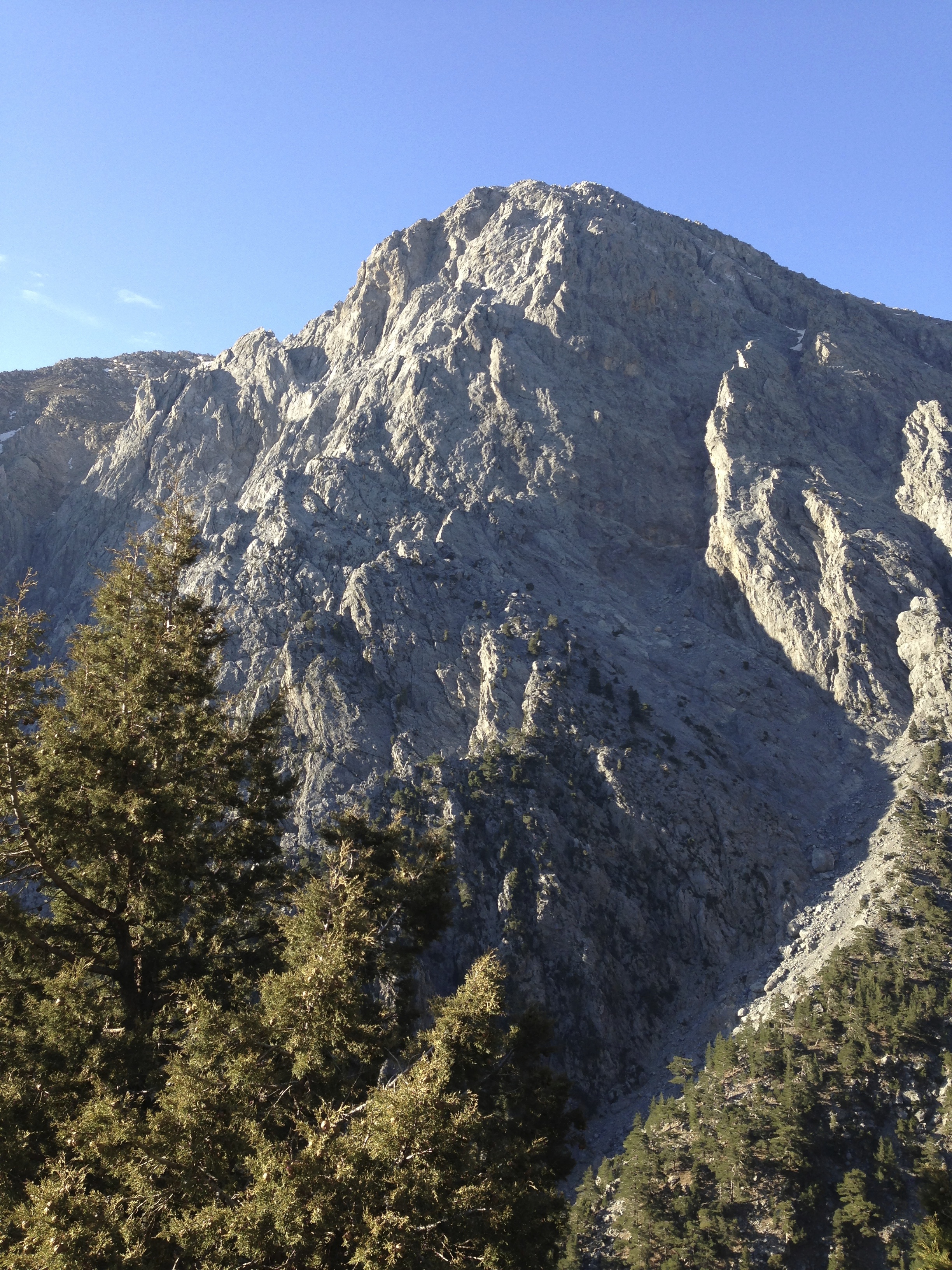
Mt Gigilos (summer holiday house of Zeus, the alpha god) at the start of the Samaria Gorge walk


IMG_1130

Looking east at the start of the walk: through a cypress pine that’s just hanging on


We start the walk down through the gorge at about 8.15 am.  The air is cool, clear and crisp and the sky is bright blue and cloudless, like a clear Australian sky and quite unlike the hazy skies of northern Europe.  The light is dappled.  The path descends steeply but is wide, very well maintained, and quite easy walking.

There are about 10 stopping points along the walk (including start and finish).  We come to the first of these after about a half hour, including many pauses for photos – a high proportion these don’t turn out because of the great sun-shade contrasts, and the breadth and height of the scenery, filling half the sky.  Early on, we pass a saddled mountain pony grazing by the path; ponies are the local ambulances, ferrying out the walkers who sprain ankles or break bones.  There must be plenty of work for the ponies through the summer, but I don’t want to be one of their customers!

IMG_1141

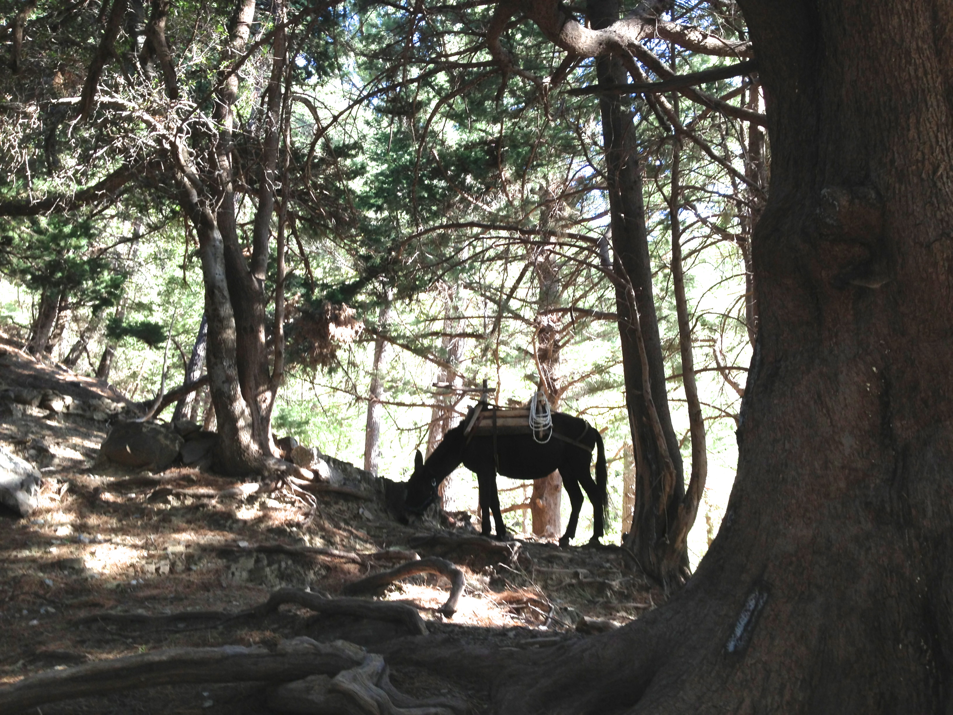
Tha Ambulance Pony takes a break


A little further we come to a couple of stones sitting on top of one another – then a couple more, then more, and soon a fallen pine tree with stones balanced along the entire length of its trunk.  It’s a self-organising Andy Goldsworthy sculpture!  Later we ask Marco the reason: he says that mountain climbers used to mark the path for those following with balanced stones, and that the custom spread among tourists.

IMG_1143

An Andy Goldsworthy without the intervention of Andy Goldsworthy


There are more of these self-organising sculptures.  Across the space under a huge rock by the path, sticks have been leant to form a little leaning-stick wall, and smaller ones lain down to form row of parallel sticks.

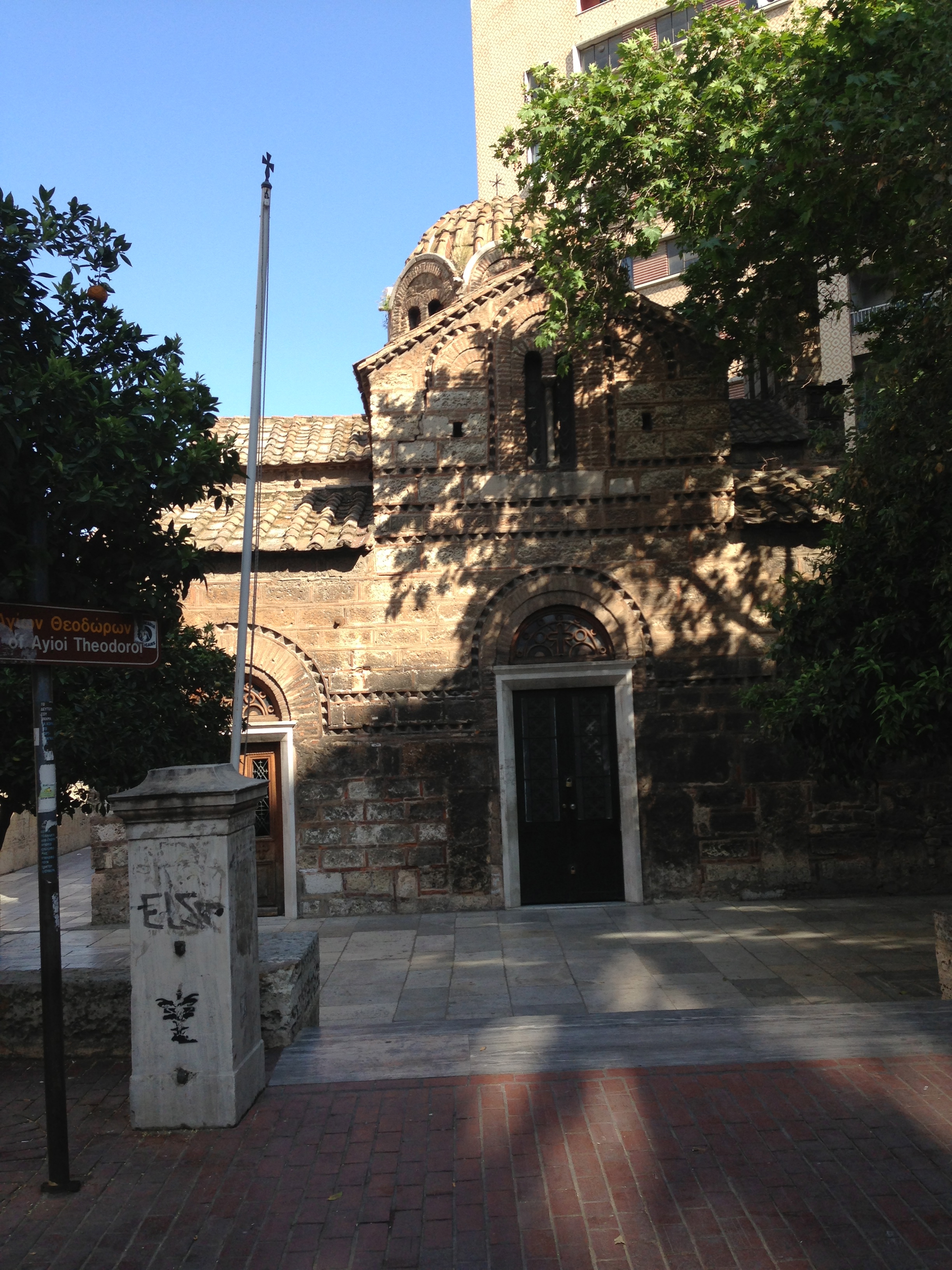
By about 9.45 am we reach Agios Nikalaos, a tiny and very pretty church by the side of the path.  This is a reminder that the gorge has been inhabited for thousands of years.  Although no-one lives here any more, the inside of the church is clean and lined with Greek Orthodox icons – the church is obviously maintained.  Marco tells us that the sites of these mountain churches had all been earlier shrines to Greek gods, and Christianity displaced the older religions partly by putting its imprints firmly on the older sites.

At all of the stopping points there are natural springs flowing into stone bowls, providing continuous drinking water as part of the (presumably ancient) infrastructure for this trail.  Clearly this water is well regarded in Crete; I had earlier bought a bottle of drinking water called “Samaria Water”, which I’m now carrying back to its alleged source!

The day is now warming up, though still pleasantly cool, and the path is winding to and fro across a small river, with stepping-stone crossings.  The vegetation is still dominated by pine but deciduous trees – mainly oak – are starting to appear.  There are herbs in the ground cover, and we see a few “dragon plants” or “dragon flowers” – a small, spiky, evil-looking plant with a single large crimson flower that emits a smell of rotting meat to attract the flies that pollinate it.

Around 11.45 am we reach Samaria, the tiny village sharing a name with the gorge.  It’s no longer inhabited, but is used as a guard post by the park rangers (whom seem to be Greek military personnel).  There are quite a few stone cottages, terraced gardens for vegetables, and many old fig, olive and fruit trees.  The grass is green and low, probably kept that way by goats (though we don’t see any).  The local wild goats are kri-kri, the Cretan goat,  a large brown horned goat that’s an endangered species and very sensibly heads for the high mountains as soon as the first walking groups arrive in spring (that’s us).

Springs run into stone bowls.  The river divides the town in two, with the path on the west and most of the buildings on the eastern side.  A wooden bridge crosses the river, which here is dry; the earlier flow, further up the mountain, has vanished underground.  The mountains tower above the place, and the atmosphere is cool, moist and green.

IMG_1182

Crossing the bridge into Samaria Village


IMG_1183

An orchard at Samaria Village, still well maintained


The last inhabitants had to leave when the Samaria Gorge area was declared a national park in 1962.  I wonder how they felt about leaving?  The place is difficult to access – the only way in and out being the path we’re following, and everything would have had to be carried in and out by people and packhorses.  However, it’s a place of indescribable beauty and tranquillity – the Rivendell of its valley – and indeed, this valley could have been the original inspiration for Lord of the Rings.

This place, far more than Knossos yesterday, lets me imagine what life must have been like for its inhabitants.  Even a few decades ago, this village would have been home for a number of families.  It would have produced much of its own food, with goats for milk and meat, vegetables, fruits, figs and olives.  Travellers perhaps used the gorge for centuries as a path across the mountains, taking the same route that we’re following.   Samaria village would have been an important stopping place, providing hospitality and receiving much of its news and exchange with the outside world in that way.  Perhaps young people left the village in search of wider horizons, leaving a progressively dwindling older population.  Perhaps the last inhabitants departed their beautiful and remote valley in 1962 with mixed feelings, not all of them of loss.


IMG_1190

A panorama from sky to river as we leave Samaria Village


We leave Samaria Village – about the half-way point in distance – after midday.  The path is now less steep, though still quite rugged, and here and there it has been roughly paved – presumably remnants of an old paved path between the village and the coast.  We cross the river – now flowing again – many times, using simple wooden bridges rather than stepping stones.


IMG_1193

Helpful advice before entering Samaria Gorge


Soon we enter Samaria Gorge itself.  The mountain walls tower above for many hundreds of metres, often in sheer cliffs.  Here and there, trees cling to crevices in the rock.  We try many times to photograph this grandeur, but it’s too big to fit onto an iPhone image.  Eventually, after narrowing progressively over a few kilometres, the gorge walls are only a few metres apart for a section of about 100 metres.  This forms “the Gates”, the most iconic part of the gorge – though far from the only part of stunning majesty.

IMG_1202

A little way into Samaria Gorge


IMG_1215

The river is flowing again


IMG_1216

Wonderful striations in the western wall
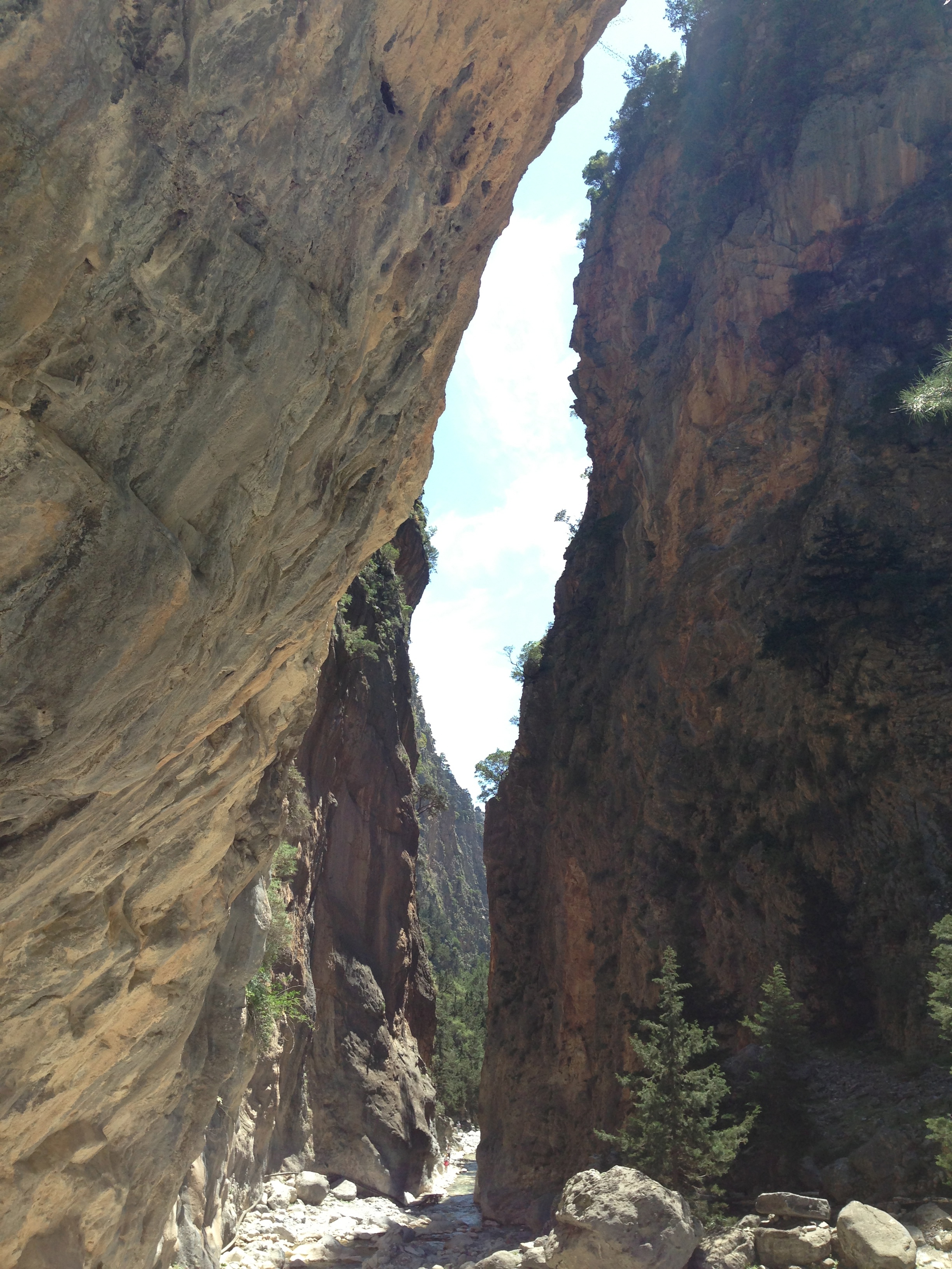
 

IMG_1223

Entering The Gates


After the Gates, the gorge tapers towards the sea. The southern park entrance is about 3 km from the coast, leaving this stretch as a pleasant walk along a dirt road with a few houses, a small church, and one tiny hermit-like door in the cliff high above the church.  There are goats in pens and tended vegetable gardens.

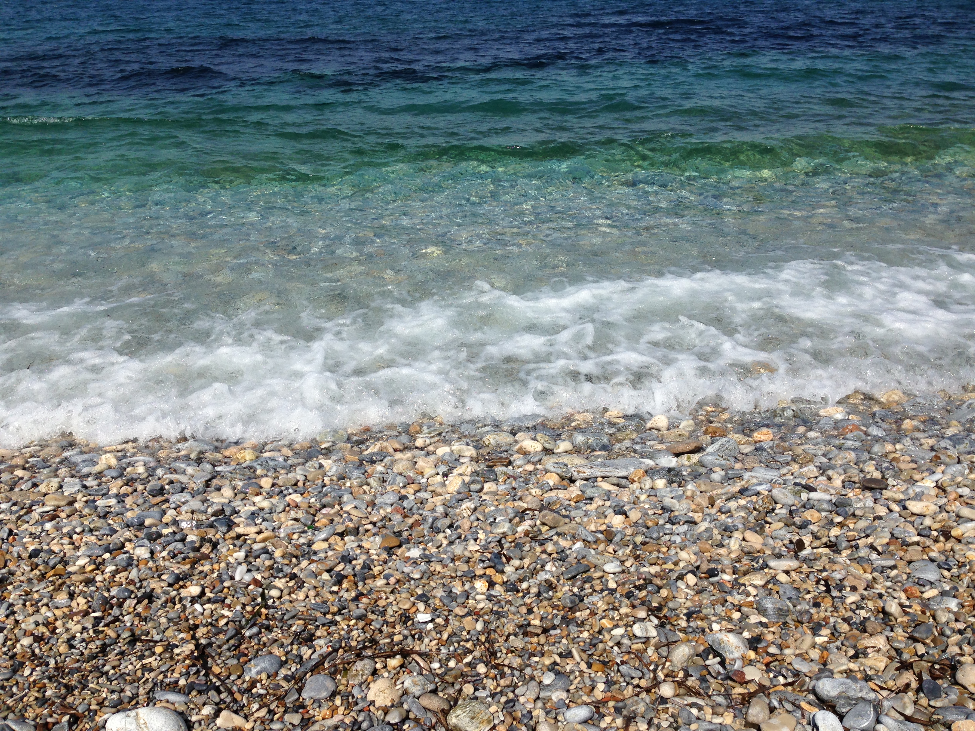
Finally, around 3 pm, a bit footsore but high on the wonder of the place, we reach Agios Roumeli for the ferry home. We celebrate with delicious (though outrageously expensive!) fresh orange juices and bowls of Cretan yogurt and honey – this yogurt is much thicker and creamier than what we’re used to.

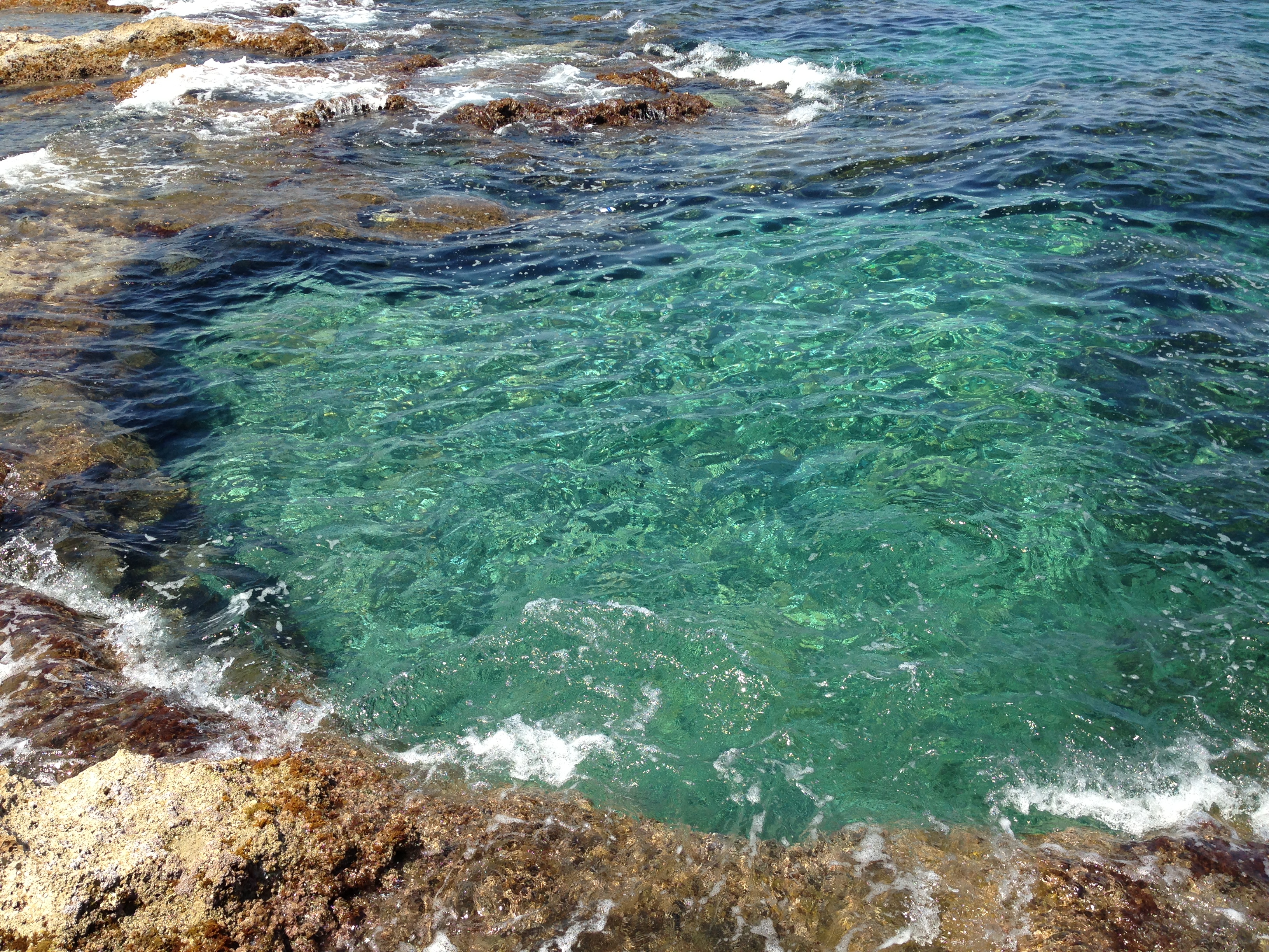
The ferry to the nearest road, at Sougia to the west, takes about a hour.  The coast is spectacularly arid and mountainous, with many caves and small gorges.  We are sailing on a very calm Libyan Sea, with Africa only 250 km to the south.

IMG_1244

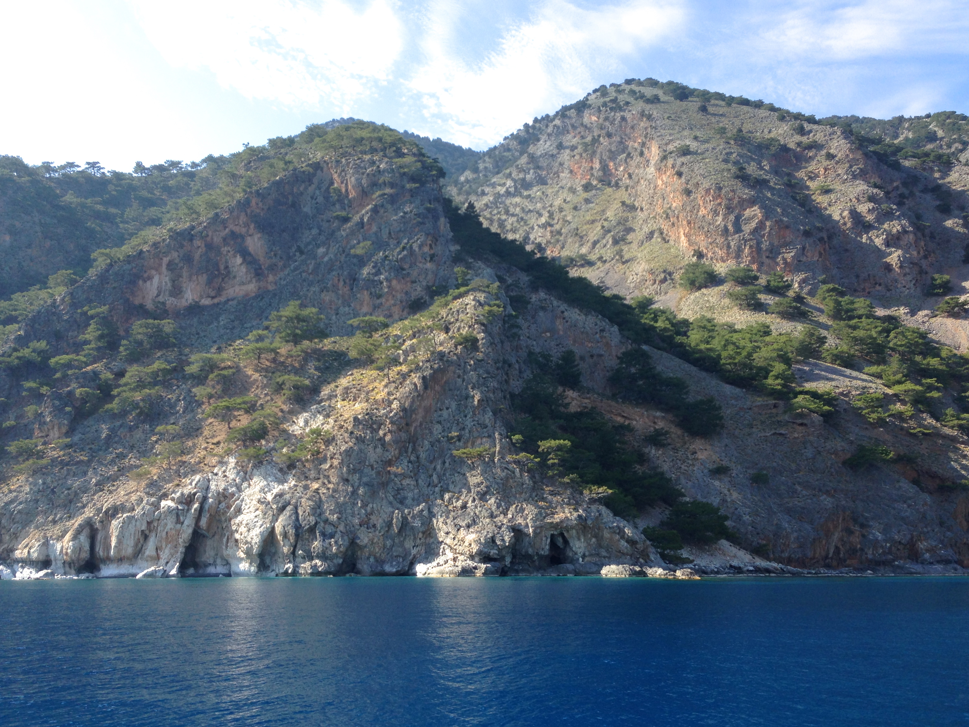
The southern coast of Crete between Agios Roumeli and Sougia


We board the bus at Sougia for an evening ride back to Chania, taking a bit over 1.5 hours to cover a direct line of only 50 km.  The road crosses the mountains with multiple twists, turns and hairpins.  The mountain countryside is cultivated surprisingly intensively, with olive orchards everywhere and small villages every few kilometres along the road.

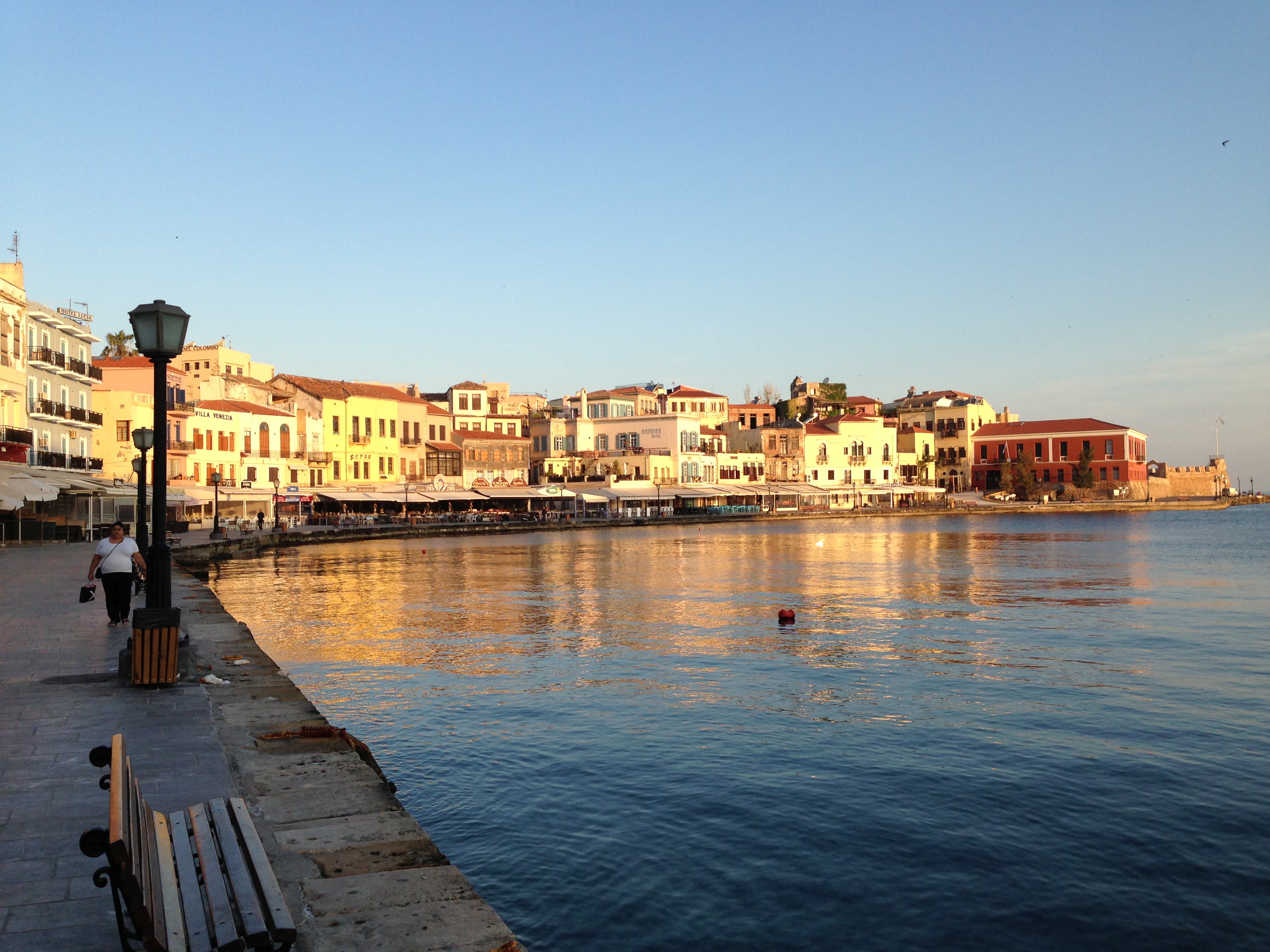
Back in Chania by 7.45 pm, we start to feel as if we’ve done some walking.  We have a quick dinner at a restaurant very near our apartment.  It’s been a fabulous day, one of the highlights of the trip so far.


Crete 3: Knossos (Saturday 27 April)

Today is our visit to the Bronze Age city of Knossos.  At 9 am we pick up the car for a drive of about 130 km to the east, mainly along the west-east National Road that follows the northern coastline of Crete.  This is an experience in many ways.  The car is a small red Chevrolet, of course with left-hand-drive for driving on the right side of the road, but also with manual transmission and a slightly tricky clutch that has to be pushed right to the floor to engage – extra degrees of difficulty on top of driving on the right.

We set off.  I’m driving and Hilary is navigating with the wonderful Pocket Earth, supplemented by a paper map.  Getting out of Chania and onto the National Road ought to have been easy, but we take a wrong turn and have to sort out a different route.  Once that is accomplished, we settle down for a 2-hour drive.  It’s fairly straightforward, but Cretan driving etiquette takes some acclimatisation.  There are lanes on the National Road, plus a service lane on the right, but lane markings – including double lines – are advisory only.  People drive anywhere on the road, often using the service lane as an extra lane. I start to do this also, as we’re slower than most other traffic (both because we’re more cautious and also because our little car struggles to get to 80 kph on a mild upslope).  Using the service lane it this way is tricky because its width varies from generous to nil, and it’s often necessary to veer into one of the primary lanes.  More unnerving is the way that people cross double lines in the centre of the road to overtake, often in situations that I’d rate as downright dangerous.  A website that I’d checked before we started describes Cretans (and Greeks in general) as “driving on the edge of safety”, and this is fully accurate.  Apparently the road toll is correspondingly high.

After a couple of hours of rather tense driving along the National Road, we reach Iraklio.  The turnoff to Knossos causes another detour because we end up in the wrong lane on the exit.  Finally, we make it to Knossos by about 11.30 am.  We have a calming cup of coffee and orange juice in one of several restaurants just outside the entrance – they all have touts, and they’re charging tourist prices, but the drinks are very welcome.  We buy tickets to the site (pretty reasonable at 5 Euros each) and head in past a bunch of private guides who are quite aggressively selling their services.  We decline all these and opt for a self-guided tour.

I’d come to Knossos in complete ignorance of what to expect, and the reality turns out to be very impressive.  It’s a big site, perhaps 10 hectares, that was a Minoan and Mycenean palace, with surrounding buildings, in the period from roughly 2500 to 1500 BC.  The city was sophisticated, with multi-storey buildings, piped water, good drainage, technologies for storage of foods and liquids in large urns, and wonderful art.  It’s a tranquil place, with lovely olives and pines growing among the old stones.  I have the feeling that it was a trading and cultural centre rather than a place of warfare.

The main excavations were led by an Englishman, Sir Arthur Evans, in two major periods each of nearly a decade, before and after World War I.   The first was mainly about excavation and preservation, but in the second, he undertook extensive “restoration” of the site by rebuilding much of the palace with a mixture of original stone and modern materials like cement, using his own interpretations of the functions of the various spaces.  Not surprisingly this has since been highly controversial.  Not only do people differ in various ways from Evans’ views about the purposes of the different parts of the palace, but the whole idea of rebuilding the ancient palace raises all sorts of historic and ethical dilemmas.  However, Evans’ reconstructions are now considered irreversible, and for better or worse are part of Knossos, so the site is now a mix of the original – pretty knocked around after 3000 to 4000 years – and the reconstructions of Arthur Evans.  My feelings on this are summed up by Catherine Tait’s profane granny: “What a fuckin’ liberty!”

I enjoy Knossos, and do my best to imagine what life would have been like whe the city was alive and humming.  However, I can’t really do this; it’s a place of old stones and reconstructions, rather than an insight into a way of life from four millennia ago.

We emerge from the palace after nearly 3 hours, have a late lunch at the onsite café (nicer and cheaper than the restaurants outside) and set off home.  Roadworks cause a detour through Rethymno (a large town halfway back), with the usual difficulty in getting back on track.  The hardest part of the whole drive is at the end, where we get ourselves deep into a maze of one-way streets in the Old Town of Chania as we try to get ourselves back to Tellus Travel.  It takes half an hour, and some negotiation of very narrow streets and tight corners, to sort it all out.  Finally we succeed in getting the car back to the travel agency unscathed – a major achievement!

IMG_1039

The entrance to the Knossos site: it’s a peaceful place once you’re past the touts

IMG_1048

A mix of ancient stones and reconstructions at Knossos

IMG_1078

Reconstructions by Arthur Evans and fellow Englishmen, done in the 1920s (cue Catherine Tait’s granny)

IMG_1090


These urns are about 2 m high

Crete 2 (Friday 26 April)

It’s a catch-up and organising day.  After a leisurely breakfast we go to Tellus Travel, a travel agent recommended by Despina, where we make bookings for ferries to Bari via Pireaus.  Also we organise a car rental for tomorrow to go to Knossos, near Iraklio.  Just on the off chance, we ask the travel agent (Maria) about the Samaria Gorge guided walk – yesterday, Despina had said that this wouldn’t be available yet.  However, Maria tells us that we can do the walk on Sunday!  We make the booking.

The afternoon and evening are quiet – catching up on diaries and blogs, walking west to a small marina (evidently in active use by local fisherman with small boats) and then back for dinner to a restaurant east of the Venetian Harbour (the Doloma) recommended by Despina because it’s run by friends of hers.  It has more of a local than touristic feeling – very nice.

Crete 1 (Thursday 25 April)

We wake around 5.40 am as the ferry is approaching Souda, the small port for Chania.  To my great joy, the headache has largely lifted.  The ferry is early, so we have to rush to pack and disembark – but the shower actually works and supplies actual hot water!  My first shower in 3 days is great; Greece does hot showers after all.  We disembark in a bit of a rush.  There is no trouble in finding the bus to Chania and then walking the half kilometre to our AirBNB apartment, by the Venetian Harbour.  We’re there by 7.30 am.

IMG_0988

What a welcome!  The Venetian Harbour of Chania in the early morning light


The apartment is just what we need; small but comfortable.  It’s in the old part of Chania neat the waterfront, west of the Venetian Harbour.  After settling in we go for a wander.  The strip along the waterfront itself is very “touristic” (as expressed by our nice AirBNB host, Despina) but the touristic intensity falls away quickly street by narrow street as you walk away from the waterfront.  We have a sort of brunch (our first meal for the day, at 11.30 am) at a nice restaurant (called Kormoronos) just around the corner from our apartment.


IMG_0999

Outside the mouth of the harbour the coast is beautiful, with crystal-clear turquoise water lapping at ancient volcanic rocks.  I take a lot of photos of the shades of colour in the water, perhaps for a collection of coastlines in closeup.


We relax for a couple of hours in the apartment, during which I catch up the diary, and then go for another wander.  This time we head for the east side of the harbour, past an interesting small domed building, a Turkish hamam (bathhouse) that now houses a craft fair.

IMG_1011

We pass an entire garden full of nasturtiums – one of Hilary’s favourite flowers


We end up at a very nice restaurant (the Tamam) for dinner, a couple of streets south of the apartment.  On our return, the laneway to our apartment looks beautiful.

IMG_1021


Athens (Wednesday 24 April)

Before the ferry arrives on time (7 am) at Pireaus, the port for Athens, I wake up with a nasty headache.  It’s one of the sort that’s hard to shake.  Also, I can’t extract hot water from the shower in our cabin on the ferry – I begin to suspect that Greece doesn’t do hot showers.  Because of the headache this could be a difficult day, as we’re set to spend it wandering around the sights of Athens, especially the Acropolis.

We have no trouble leaving the big bags in a locker and catching the metro to Monastriki, the station for the Plaka area just north of the Acropolis.  We have a coffee in a nearby Starbucks, because coffee sometimes shakes these headaches loose, but this one is set in for the day.  We head for the Acropolis anyway.  It’s a bit of a blur for me. Although the temperature is only around 20 C, I feel hot and seek what shade there is (along with hordes of other tourists).  I have the impressions of great antiquity (obviously), of a layered city that has been rebuilt every few hundred years from the stones of older cities, and of the amazing strength and novelty of the civilisation that built the Parthenon and the other great monuments of the Acropolis.

We spend less than 2 hours on the hill of the Acropolis.  I need shelter, and Starbucks is all there is on offer; we spend the next four hours there, with Hilary being very kind and patient.  By around 4 pm the headache is lifting to the extent that I can face a gentle walk around the streets of the Plaka area; we look at graffiti (lots of that, some of it very angry).  We also walk around a few of the many churches.

IMG_0981

The old is often dwarfed by the new in the Plaka district


We have yogurt, fruit and honey in a little restaurant, which is very nice, and then head back to Pireaus to catch the ferry to Chania in Crete.  This ferry is even bigger than the one from last night, and is new and luxurious.  We walk around a bit on the top deck (it has a Pet Hotel where dogs travel with a special Dog Whisperer) and go to bed soon after the ferry sails at 9 pm, passing up a wealth of food on offer in several restaurants.

IMG_0987

A comfortable cabin for a night crossing from Pireaus to Chania


Samos 2 (Tuesday 23 April)

Overnight, the hotel room turns out to be less than ideal: single beds, only one blanket per bed, and no hot water for a morning shower.  We emerge cold and unshowered, and decide that one way or another, we’ll move on today.  I tell the proprietor, who is clearly disappointed.  He obviously needs clientele, as the place has the feeling of being on the edge of collapse.  I give him an extra 5 Euros because our plans changed – perhaps too generous, given the state of the hotel.

We have only a EUR50 note to pay him and he can’t give us change, so we go to a small café in the hospital over the road to get 20+20+10 for the 50.  This leads to the first of a couple of interesting conversations about the state of Greece.  The café attendant (also owner, perhaps) is a nice guy who begins by making a big play on the history of my EUR50 note: “Where did this come from?  Is it from Germany or did you get it in Greece?”  I say that it came from an ATM down the road.  “Ah, Greek Euros – no good, you see!”  I think at first that he is telling me I have a counterfeit note.  Hilary realises before me that he is actually giving us his perspective on the state of the Greek economy (as well as having a lend of me).  We chat with him for another 10 minutes, learning that his diagnosis of the problem is “it’s the politics – the people work hard and try their best, but the politics makes all the trouble”.

IMG_0939

Samos is the birthplace of Pythagoras.  Here Hilary pays homage with a yoga position, The Triangle.


IMG_0940

Aegean coastline colours (maybe the first of many such pictures)


Our next stop is a travel agency, to find out about ferries from Samos to Crete.  This is the information I had not been able to get from the net in several previous attempts. It turns out that there are no ways to get from Samos to Crete other than through Pireaus (the port for Athens) on two successive overnight ferries.  We go ahead and make the bookings, for sailings tonight (departing at 4 pm) and tomorrow night.

Then follows the second interesting conversation.  We gently question the travel agent (whose name is Dmitri) about life in modern Greece.  He is slim, tall, 50-year-old-handsome and a heavy smoker, though not in our presence.  When given the chance to express his feelings, he doesn’t hold back. He is very angry about the state of Greece, and concerned for the future of his children and their generation; his son can’t get a steady job despite a good education, and youth unemployment is officially 30% but he estimates that it’s really over 50%.  He sees the economic problems as following from several things:  Greece’s inability to float its own currency (“but we invented money! The drachma is 4000 years old, and it’s just been blown away in a puff of wind!”); Greece’s foreign debt (“but it’s trivial compared with the debts of other countries!”); and Germany’s failure to pay war reparations after WW2, as (he says) they did to many other European countries.  He points to population decline: decades ago the Greek population was 20 million but it has now shrunk to 10 million, because of emigration of young, skilled people – a loss of the country’s future.  He also sees refugees as a huge problem: Greece has 3 million, largely from Arabic countries like Syria.  He sees the only way out as revolution, perhaps after the summer (because Greece needs its tourist income). He thinks that there is no leader for the anger in the hearts of ordinary Greeks, but that a revolution will happen anyway.   He is also very knowledgeable about Australia politics and goings-on, through a friend who worked in Radio Australia.

A hallmark of this conversation, over nearly an hour, is its intensity.  We had guessed that there must be anger around at the way Greece has been done over by the global banking system; this is a glimpse of it.

Because of our looming 4 pm ferry departure, we now have only a few hours left to spend in Vathy.  We walk through Old Vathy and up the hill to the east of the harbour for a few kilometres.

IMG_0945

In the Old Town of Vathy, the kids like to practise English by saying hello


We grab a quick lunch near the square (again) on the way to collect our bags by taxi and board the ferry.  It is a much bigger boat than the one that took us yesterday from Turkey to Samos.  We get a comfortable sleeping cabin with a window.  After the ferry sails we sit down in the lounge area and get into conversation with a Canadian couple , Graham and Betty.  They are very nice and very talkative (though Graham thinks that Canada’s exploitation of tar sands is a really good idea …).  We have dinner together before a night aboard the ferry as it chugs from island to island across the Aegean.

Samos 1 (Monday 22 April)

After a very comfortable night in our big 4-star hotel room, we walk to the waterfront for the 9 am ferry to Samos. The small ferry takes about an hour for the crossing.  First glimpses of Samos are riveting: it’s a large island, 30 km east to west, with mountains up to over 1000 m at the western end.  There are little villages along the water.  The ferry docks in the harbour of Vathy, the largest town on the island.  We look for a Pythagoras Hotel, following the Lonely Planet book on Mediterranean Europe, which has become an indispensible guide.  The hotel is located fairly easily, and we check in – we see no other guests.  The place is basic but our room has a great view to the south over the harbour and a range of hills behind; it will be fine for a couple of nights, our intended stay.

IMG_0911

The idyllic harbour near the hotel

We head out into the late morning to explore Vathy.  It’s a small, quiet, picturesque town with few tourist trappings and uncrowded streets.  It’s utterly different to the Turkish cities that we’ve passed through in the last week – Kusadasi, Izmir and especially Istanbul.  We stroll the streets and sit down in a café on the main square for an extended pre-lunch coffee; a delightful spot with easy chairs to lay back and watch the passers-by and the sea.  The only thing is that “café” here means a place that serves drinks and only light (if any) food.  We have a late lunch at another restaurant on the waterfront.

The main square has an imposing statue of a lion, and (according to the Lonely Planet, written in 2009) – four palm trees.  Now, three of the trees are stumps!  We don’t know what happened to them.  One lone palm remains to keep the lion company.

There are many Greek Orthodox churches, evidently maintained and used, but no mosques despite Turkey being less than 20 km to the east.

We’re seeing the place with some preconditioned expectations because of all the reportage of Greece’s financial woes.  Indeed, there are many shops closed and empty shop windows.  Many of the remaining shops look to have stock that is old and thin.

We look for a place for a light dinner, and go to the liveliest café in town.  This provides sandwiches – all we need – and most importantly it has excellent public wifi!  Connections since leaving Istanbul have been difficult, and there is a backlog to catch up – emails, blog posts, news and so on.  I spend a couple of hours into the darkness getting my travel blog up and going, with entries for Istanbul up to last Thursday and a few photos.

Kusadasi (Sunday 21 April)

We have a good breakfast in the tiny breakfast room at the Guzel Izmir Hotel – all part of the price, so the value is fine even if the room is quaint.  After packing, we try to check Greek ferry connections to work out an island-hopping route to Crete.  This proves difficult, partly because the wifi connection keeps dropping out, and partly also because the Greek Travel Pages website – our main tool for getting ferry routes and times – is a bit of a dog.  You can only search for single journeys, not journeys with multiple ferry connections; you need a detailed knowledge of the various ports and islands to know which connections to search; and, most troublesome of all, many of the less major ferry routes only operate in the high season, starting in May or June, and aren’t available to us in late April.  After several hours battling these obstacles, we establish a few alternatives.  All of them involve multiple island hops, taking 3-4 days all up, with many 12-hour waits on islands and in every case at least one arrival or departure in the middle of the night (1 am to 6 am).  Is this going to be harder than we thought?

We are both getting a bit frustrated, so a bit after midday we go for a short walk around the nearby streets in Izmir.  It’s a gritty working area, with a lot of small shops and cafés with men (no women) passing the time of day in conversation.  There are no concessions to tourists – we are off that beaten track.  We have lunch – by chance at the same place we had dinner the night before, where the owner remembers us.  Again, the food is cheap and just fine, though definitely not haute cuisine – it’s the Turkish version of the kind of food you’d expect in a working area anywhere.

Still uncertain of our next move, we try to do more research in the basement lounge of the hotel, kindly made available to us.  The net connection here is better but still not perfect.  By now it’s about 3 pm, and we’ve achieved nought in the whole day.  We make a snap decision to go to the Greek island of Samos, just off the Turkish coast, in order to keep moving and because we can get there fairly easily.  The journey from Izmir to Samos involves a 1.5 hour bus trip to Kusadasi, a town on the coast about 100 km south of Izmir, then a 1 hour ferry journey at 9 am tomorrow morning – all quite doable.

The bus terminal is very close, just around the corner by the station.  We buy bus tickets (very cheap: AUD12 for a 100 km journey) at an agency on the street, and wait for the bus; a minibus turns up at 4.30 pm, on schedule, and we are waved onto it.  It’s cramped but OK.  However, it then heads off in the wrong direction!  Are we on the wrong bus?  It turns out that we simply don’t know the system.  The minibus is just to take us to a huge bus depot where perhaps 100 big buses are waiting, with departures every minute or two for every imaginable destination across Turkey.  We are waved onto the bus for Kusadasi, which departs soon after.  It’s big, spacious and very comfortable, with a cabin host who plies the passengers with snacks and drinks throughout the journey – all for AUD12 each!  We’d heard that the Turkish bus system is good, and to experience it in action is quite something.

At Kusadasi we opt for a 4-star hotel, to spoil ourselves after the cramped room in Izmir.  Even this is relatively cheap. The hotel man organises the ferry to Samos for us for the next morning.  In the early evening we walk down through the town to the waterfront, and out onto a small island with a castle (under restoration), all connected to the mainland by a causeway.

IMG_0889

The sun sets picturesquely across the Aegean.

We choose a restaurant in town for dinner.  Kusadasi is a tourist town so there are plenty of options, with touts waving us in, though it is far from crowded – no doubt things will crowd up later in the season.  Many of the bars are Irish-themed, and we hear a few Irish accents around.  We go for one with no tout, where the food is reasonable and the owner is friendly.  We ask him about the Irish connection – he doesn’t know the reason, though he has spent time in Ireland and speaks excellent English with an Irish accent!

Izmir (Saturday 20 April)

Today we go to Izmir, still uncertain as to whether we will go south to Bodrum or Marmaris on the Turkish coast (and thence to Crete) or west to one of the Greek Aegean islands – probably Samos or Chios.  We’ll work out the next step from Izmir.  This is also the start of our journey west across Mediterranean Europe.  Our intention is that from here on, the whole trip will be by surface transport until we take the long flight home in 2 months time.

We pack up and leave Hatice’s lovely Istanbul apartment by 11 am, and take a taxi to the ferry terminal at Yenikapi – no problems with a dishonest driver this time, and I tip him 20% (about AUD2) in thanks.  We take a 12.30 pm ferry to Bandirma, on the south shore of the Sea of Marmara; the ferry crossing (about 2 hours) is efficient but crowded.  In compensation, the crowd is a very interesting one, with many families and single travellers and almost no tourists, ourselves excepted.

We proceed by train from Bandirma to Izmir (a 7 hour trip, arriving about 10.30 pm).  The train is comfortable, and soon after departure is quite full of travellers – a group of teenage Muslim girls with hijabs are laughing and playing with a baby, like teenage girls everywhere.  We pass through lush, productive agricultural countryside with occasional small towns.  The main land uses seem to be cropping and orchards; the few hills are steep and are not grazed but left for woody regrowth, perhaps after clear-felling some decades ago.   We arrive on time at Basmane Station in Izmir, after a nice journey.  We find the Guzel Izmir Hotel (booked from Istanbul) just around the corner from the station.  It’s definitely 2 star accommodation, with a tiny room, two single beds, and very patchy wifi that drops out a lot!  We look for somewhere to eat at 11 pm – the streets are still pretty active.  We find a place just around the corner from the hotel where the food is cheap and OK, though chips now seem to be standard in Turkish cuisine.

Istanbul 5 (Friday 19 April)

After some housekeeping we head out from the apartment around 10.30 am, and immediately meet the English speaking friend in the shop again; he enquires about our activities (we’ve ticked all his boxes!) and suggests a good Bosphorus cruise.  We decide to go with his suggestion.  First we go to the Grand Bazaar again where Hilary wants to see the fabrics section – she buys a nice red scarf.  (Amazing sight on the way: a man with a huge stack of circular bread rolls, balanced on a plate on his head).  We go to the ferry terminal for our departure at 1.30 pm.

The cruise zigzags from stop to stop across the strait as it heads north.  We pass under the two Bosphorus Bridges linking Europe to Asia.

IMG_0830

Europe in front of us, Asia behind


We dock at a small town called Anadoli Kavargi on ther Asian side of the Bosphorus.  It’s tourist-oriented, with fish restaurants and a castle on a hill.  The boat stops here for 2 hours, so we walk (with about 50 other passengers) up to the castle.  This gives great views of the opening of the Bosphorus strait into the Black Sea, and of the many passing ships.  I can report that the Black Sea is misnamed: it is a pure, dazzling blue.

IMG_0849

The Black Sea is not black


IMG_0855

Letting sleeping dogs lie in Anadoli Kavargi


We have icecreams in one of the small cafés to round out a very nice trip.  Hilary says that being on the water always make her feel happy (which is good, because we have a fair few ferry trips still to do!)  Dinner is at the other restaurant near the Galata Tower, as recommended by the English-speaking friend from the local shop.  We walk home through the Friday night Beyoglu nightlife as it warms up.